
Memorial Day Weekend Colorado Storm Chasing
Memorial Day weekend ended up being a great opportunity to do storm chasing in Colorado as Sunday and Monday had much of the eastern plains in the “enhanced” to “moderate” risk according to the Storm Prediction Center (SPC). I was coming back from camping on Friday and Saturday, so I was surprised to see a moderate risk day assigned to eastern CO on Sunday. After church, I made my way out to the plains near Arriba, CO before heading south to Hugo.
There I encountered a high-precipitation (HP) supercell that had just become tornado warned, but there was so much heavy rain that it was impossible to take any pictures and frankly, I just wanted to avoid large hail. I was initially planning on driving to Burlington and camping out there, but the big storm was to the south near Cheyenne Wells and Sheridan Lake, where several brief tornadoes were produced by a classic looking supercell. There were more than enough storm chasers there so I decided to head back toward Denver, I saw a few small cells along the way and took pictures and even got a decent (albeit brief) timelapse. I would say that I got skunked on Sunday, I wasn’t in the right position and wasn’t willing to core punch the Cheyenne Wells storm.
On Monday, I wasn’t planning on storm chasing but when the SPC moved their enhanced risk further west to include most of NE Colorado I couldn’t sit that one out. I headed toward Ft. Morgan and got in front of a thunderstorm that had briefly been tornado warned, I found some county roads near Brush and proceeded to watch the storm cycle into a beautiful supercell and I even captured a brief gustnado. More interesting was the cloud formation above that was rotating almost horizontally, I’ve never seen anything like that before.
I made my way back to I-76 after seeing lots and lots of storm chasers going toward that storm, so I headed further NE toward Sterling where it looked like the storm was getting better organized. Just outside of Sterling, there had to have been 80+mph winds, my pickup truck was moving and I was certain the semi-truck in front of me was going to be blown over. I pulled over at Sterling and watched the radar for a few minutes, then got the familiar tornado warning notification. Just then more wind picked up and I decided that I didn’t want to find out if there was indeed a tornado, I headed toward Holyoke, CO on US 6 as the storm was racing along, I have never seen a storm move that fast. I reached Flemming as I heard tornado sirens there and a new tornado warning notification, finally I pulled over outside of Flemming to take a few photos of the beastly storm. Deciding I had had enough, I went a few miles south of Haxtun to take some more photos, then head back to enjoy a dinner with dear friends in Loveland.
Overall, Monday was a very exciting and fun chase though there were a few scary moments. I observed some terrible storm chasing behavior, a topic that is getting more and more traction these days. Bottom line; obey traffic laws. You put other people at risk when you do not observe and follow traffic laws. You’re a driver first, storm chaser second.

Looking west at the wall cloud as it was about to enter flemming, CO. This was one of the first storms where I felt the storm was chasing me instead of the other way around.

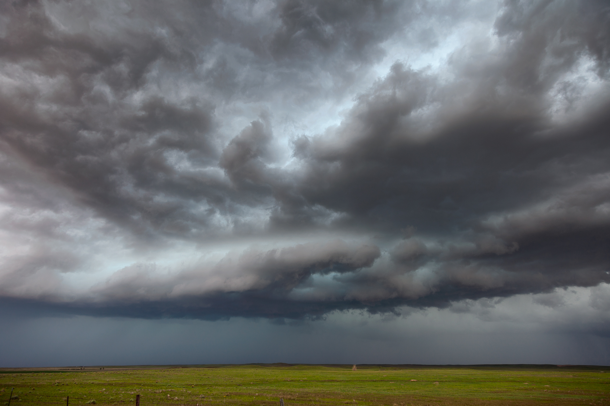
Just goes to show you that even with two tornado warnings within 100 miles of this location, the colorado high plains can be incredibly peaceful and serene. this is one of my favorite locations to shoot on the plains and I want to capture it again with lightning.
Just north of Ft. Morgan, CO the storm really started to intensify. The aquamarine clouds signify that there is a hail core because of the strong updraft.

A stat-padded tornado! Very brief ground circulation from a loose funnel cloud above it, this was the first of two very weak and very brief tornadoes I witnessed that day.

One of the most jaw-dropping storm clouds I’ve seen, there was a horizontal bend in this updraft. It was unbelievable to watch.

One more panorama from the wall cloud outside Flemming, CO.